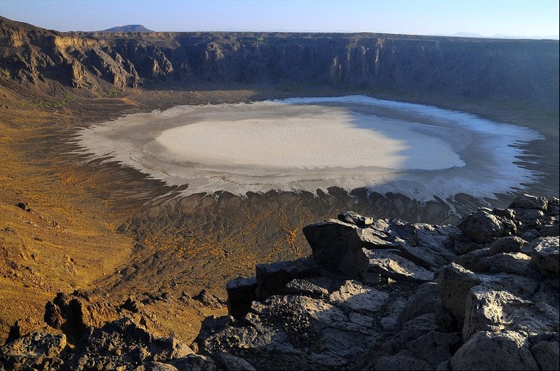
Al Wahaba Crater
Published On Mar 23, 2021

The Al Waba crater (Maqla Tamia in Arabic) is 254 km from Taif on the western edge of the Harrat Kishb basalt plateau, which contains many volcanic cones. It is 250 m (820 ft) deep and 2 km (1.2 mi) in diameter. The bottom of the crater is covered with white sodium phosphate crystals.
While it was thought for some time that the crater was formed by a meteorite, as its appearance resembles that of the Barringer Crater, with its circular form and high sides, it is now commonly accepted by geologists that the crater is a maar crater, and was formed by volcanic activity in the form of an underground phreatic eruption – a massive steam explosion generated by molten basaltic magma coming into contact with subterranean water.
The remains of date palm plantations can be found halfway down the side of the crater, but they are disused. There are springs near the plantations. It’s easy to climb down from the rim to the bottom of the crater there from the North side on a prepared path, although most of the circumference has steep, unclimbable cliffs. At the top of the path is a stone hut which contains rubbish and debris, and some suitable places for camping, although there are better places to camp to the South (see below).
In the north of the Waba Crater, there is some vegetation located. It takes a person 15–25 minutes to go to the bottom of the crater. This crater is very slippery and it is hard for people to come up to the surface. To climb back up takes approx 20–40 minutes. There is only one paved route down into the crater. It is not recommended to climb down in groups of less than 3, as the path is quite loose in places and the risk of accident, whilst not huge, is ever present. Furthermore there is no mobile signal within the crater, and the site receives very few visitors indeed, even over weekends.
The best camping sites at the crater are on the south side just above the palm trees, which afford excellent views and where the ground is flat and secluded.
Since the year 2000, Saudi Tourism has discovered the site and paved roads and signs have been placed to expedite travel. To reach the site from Jeddah take the Taif-Riyadh highway. After 161 km from Taif leave the highway at Khanfariyah – Umm Al-doom exit and turn left over the bridge (this is the second bridge after the town of Radwan). After 31 km turn left again to Umm Al-doom town and after another 61 km turn right where the brown Al Wabah signboard is located; the road ends at the crater’s edge.
The road North to Mahd Adh Dhahab is now paved (signposted merely as Mahd, and is 90 km North of the crater), which allows much easier access to the site from Medinah, Rabigh, Yanbu, King Abdullah Economic City and KAUST, or allows visitors to do a trip north from the crater to Al-Ula or the White Volcanos, which would not have previously been feasible in a long weekend trip.